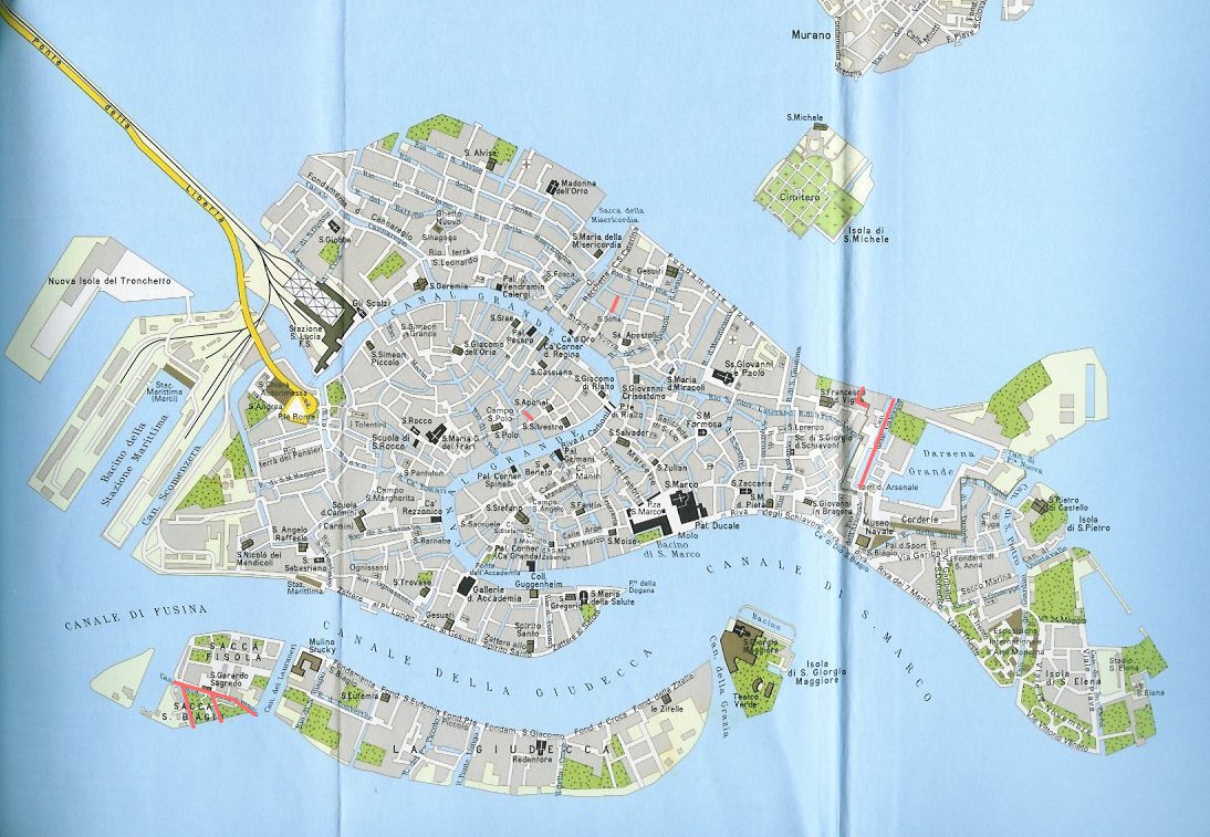
A couple of weeks ago I made a map of the rii of Venice where I had never been paddling – I had made a few mistakes which I have updated on the original post.
Since then I have looked for occasions to paddle through some of the few remaining rii, and the list has been shortened considerably, as of this map.
The remaining un-paddled rii are:
- Rio dei Meloni, S.Polo (N part only, there’s an unpassable bridge in the middle)
- Riello S.Sofia, Cannaregio (dead end)
- Rio dell’Arsenale, Castello (dead end at the Celestia vaporetto stop)
- Canale delle Galeazze, Castello (inside the Arsenale – navy area)
- Darsena Arsenale Vecchio, Castello (inside the Arsenale – navy area)
- Canale Sacca Fisola (Giudecca)
- two nameless canals on Sacca Fisola and Sacca S.Biagio.
These rii have been traversed since last:
- Rio di S.Giobbe, Cannaregio
- Rio S. Maria Maggiore, Dorsoduro (both parts)
- Rio delle Burchielle, Dorsoduro
- Rio della Cazziola, Dorsoduro (only kayaks can get through)
- Rio Briati, Dorsoduro
- Rio delle Erbe, S.Polo
- Rio S.Michiel, S.Marco
I have taken the liberty of keeping Rio S.Andrea out of the tally, as it is completely closed off at this time. Half of it is interred, and the other half is currently without water.

Leave a Reply